Water Control Data System Menu
UPPER RED RIVER BASIN
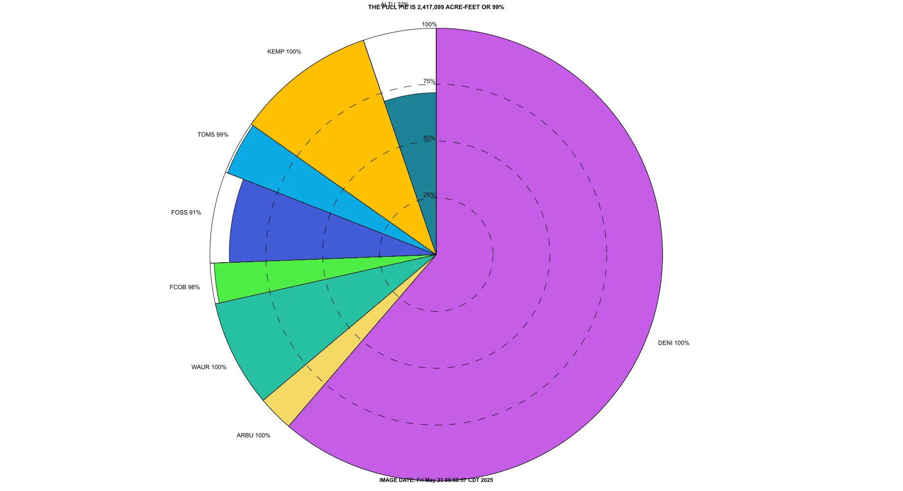
Upper Red Conservation Pool

The size of the pie slice is proportionate to the lake's share of the total Conservation storage in the Upper Red River Basin.
The radius of the pie slice indicates the percent of the lake's Conservation storage that is filled at the time indicated.
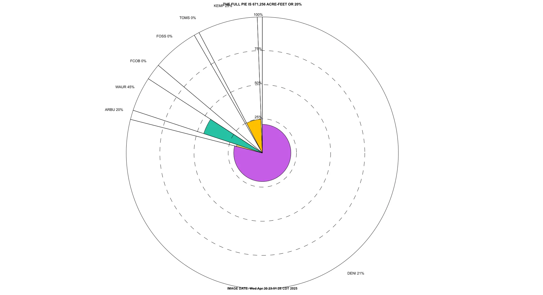
Upper Red Flood Pool

The size of the pie slice is proportionate to the lake's share of the total Flood Control storage in the Upper Red River Basin.
The radius of the pie slice indicates the percent of the lake's Flood Control storage that is filled at the time indicated.
Click on a lake name below to get graphical data for that lake.
Altus Dam
Kemp
Tom Steed
Foss
Fort Cobb
Waurika
Arbuckle
Denison
